Apple Rolls Out All-New Maps In India With 3D Landmarks And Local Language Labels
Total Views |


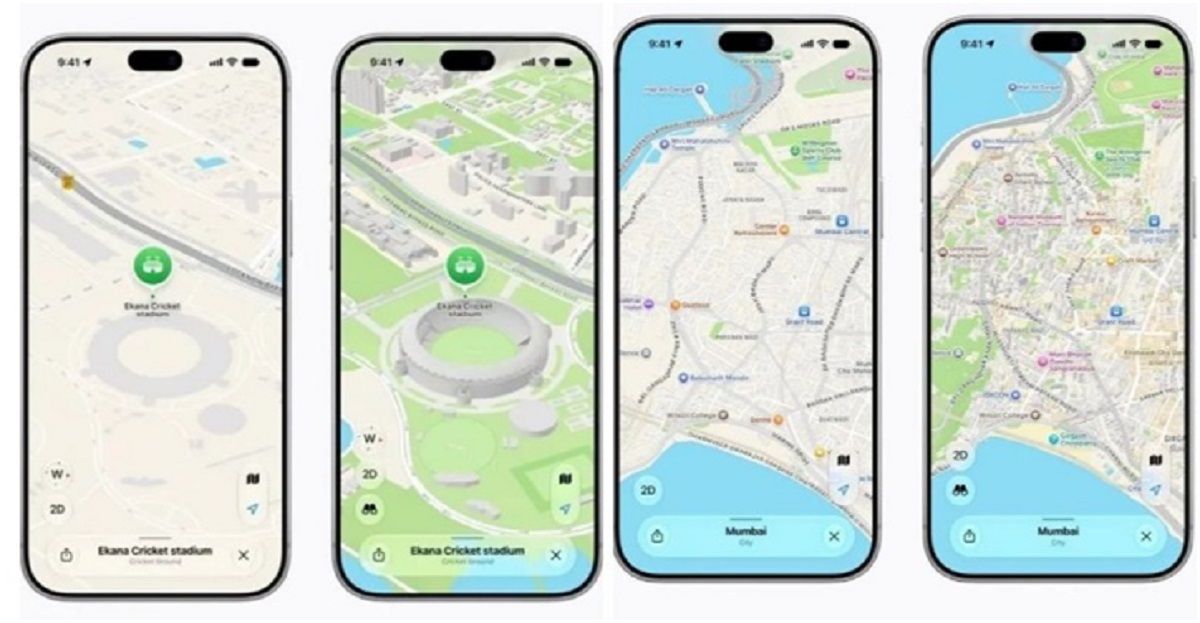
Apple has rolled out an all-new Maps experience across India. It offers faster and more accurate navigation, cleaner views of roads, buildings, parks and shopping centres, and over 300 three-dimensional (3D) landmarks. The update includes features made for Indian users, such as better Natural Language Guidance and dual-language labels.
Enhanced Natural Language Guidance
Natural Language Guidance gives directions that sound like everyday speech, such as "At the next traffic light, turn left". For India, Apple has added real-world details like pillars and other landmarks. This helps drivers on roads with directions like "Turn right after the petrol pump".
apple-maps-india-3d-landmarks-natural-language-guidance-dual-language-labels
Apple has enhanced the new Apple Maps for India to be more useful and relevant by adding real-world details, such as pillars and other points of interest that help users find their way more easily in a country where local roads often are unnamed. (Image Credit: Apple)
Dual-language labels
Apple says many signs in India show both English and a local language. So Maps now shows labels in the user's device language and the local language of the area. A person using English will see Hindi and English in Delhi, and Marathi and English in Mumbai. Maps supports English and Hindi, and now also Bengali, Gujarati, Kannada, Malayalam, Marathi, Tamil, Telugu, Punjabi, Odia, and Urdu.
Apple notes that both enhanced natural language guidance and dual-language labels require iOS 27.2, iPadOS 27.2, watchOS 27.2 or macOS 27.2 or later software.
Lane guidance and multi-stop routing
Lane guidance helps drivers pick the right lane before a turn or an elevated road. With multi-stop routing, users can plan up to 15 stops. Routes sync automatically from Mac and iPad to iPhone.
Share estimated time of arrival (ETA)
Users can also share their estimated time of arrival (ETA) with a tap, and Maps will update the ETA with the people a user has shared it with if there is a big delay.
apple-maps-india-3d-landmarks-natural-language-guidance-dual-language-labels
Apple Maps in India now offers interactive street-level imagery, with high-resolution 3D photography and smooth and seamless transitions with Look Around. (Image Credit: Apple)
Report accidents, hazards or speed checks
Apple says drivers can report an accident, hazard, or speed check by telling Siri AI, without taking their eyes off the road. They can also report when a problem has cleared.
Electric charging stops along the route
For some electric vehicles, Maps can plan trips with charging stops by checking hills and other factors along the route.
Plan journeys, find nearby stations, and pin favourite routes
Public transport riders in Ahmedabad, Bengaluru, Chennai, Delhi, Hyderabad, Kolkata, Mumbai, and Pune, and on Indian Railways, can plan journeys, find nearby stations and pin favourite routes. They also get an alert when it is time to get off.
Look Around and AR Walking Directions
Look Around offers street-level photos in high resolution, with smooth transitions. AR Walking Directions let users raise their iPhone to scan nearby buildings and see step-by-step directions in the real world.
Other features include cycling directions with details on hills, bike lanes, and stairs. Custom Route Creation lets users draw a path along trails or roads and save it. Preferred Routes uses the iPhone itself to learn regular journeys, such as home to work, and shows a preview of the commute.
Privacy
Apple says privacy is built into Maps. No sign-in is needed, and personal features run on the device. Data is linked to random identifiers that reset often, and search locations are blurred on Apple's servers.